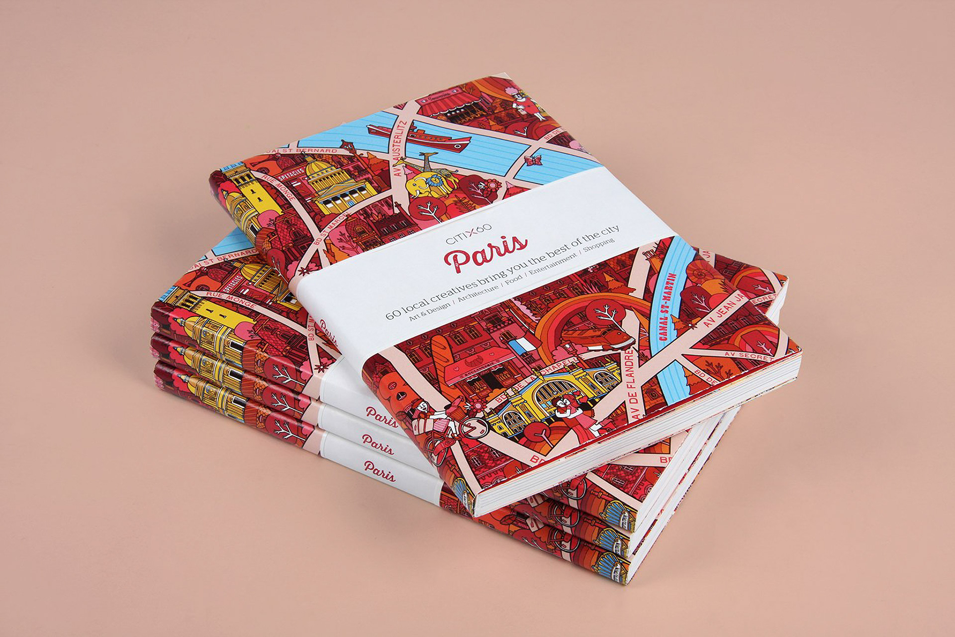
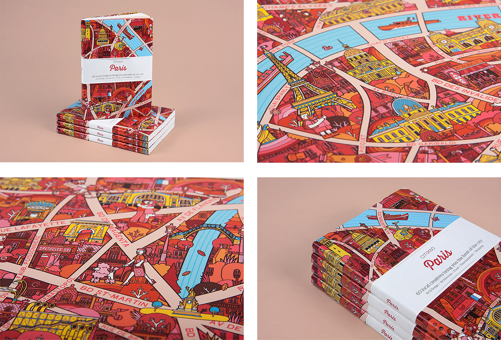
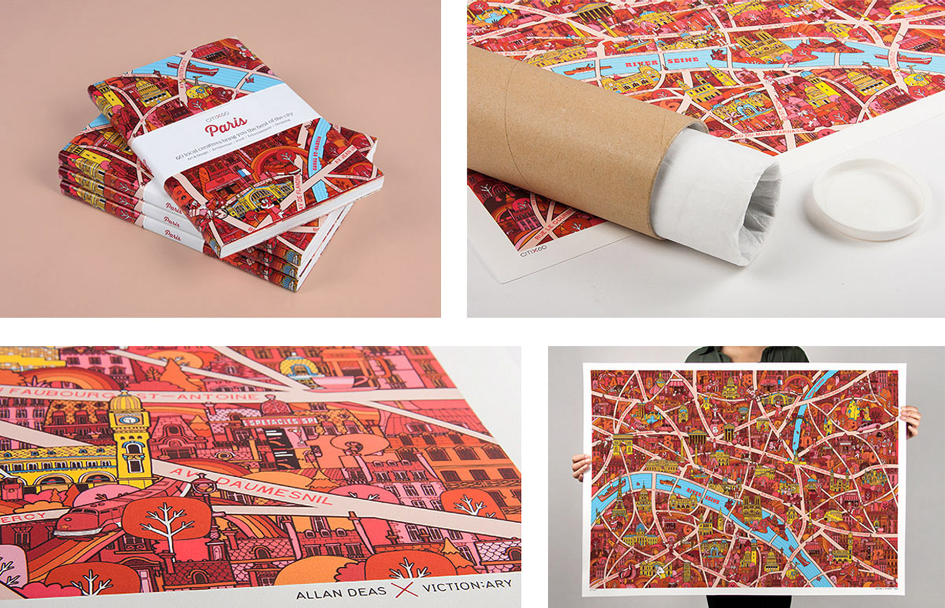
An Illustrated map collaboration for Hong Kong based design publisher, Victionary called the CITIX60 project, where a different designer created the map for each guidebook for a range of world famous cities. Fold out map doubled as the book cover for each destination.
The design orientated travel guides were also based on first hand recommendations and favourite haunts of creatives in each of the city destinations with recommendations for bars, restaurants and cultural venues.
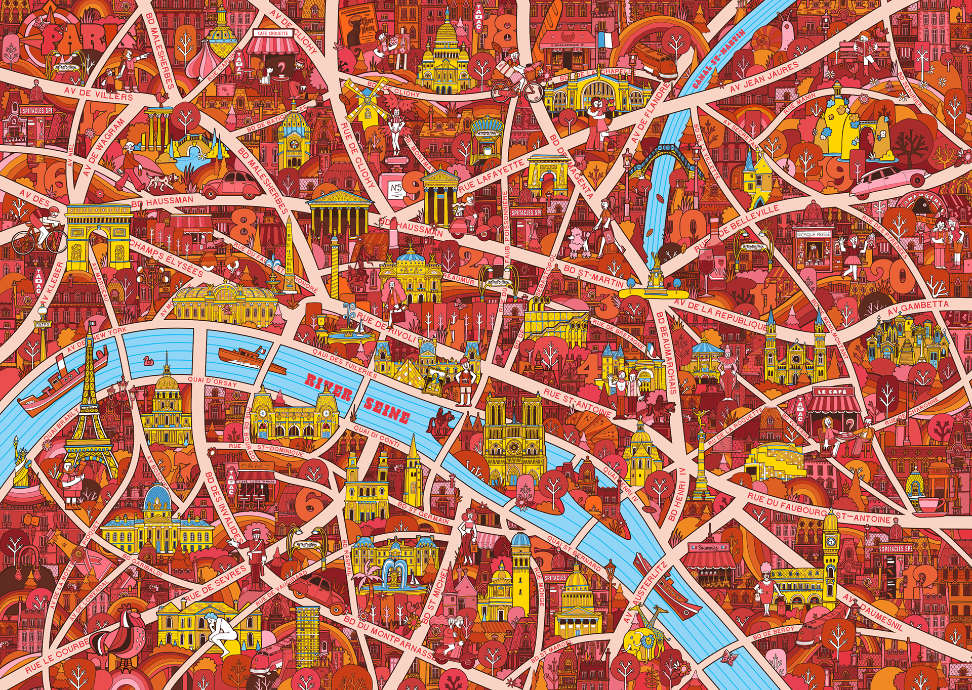
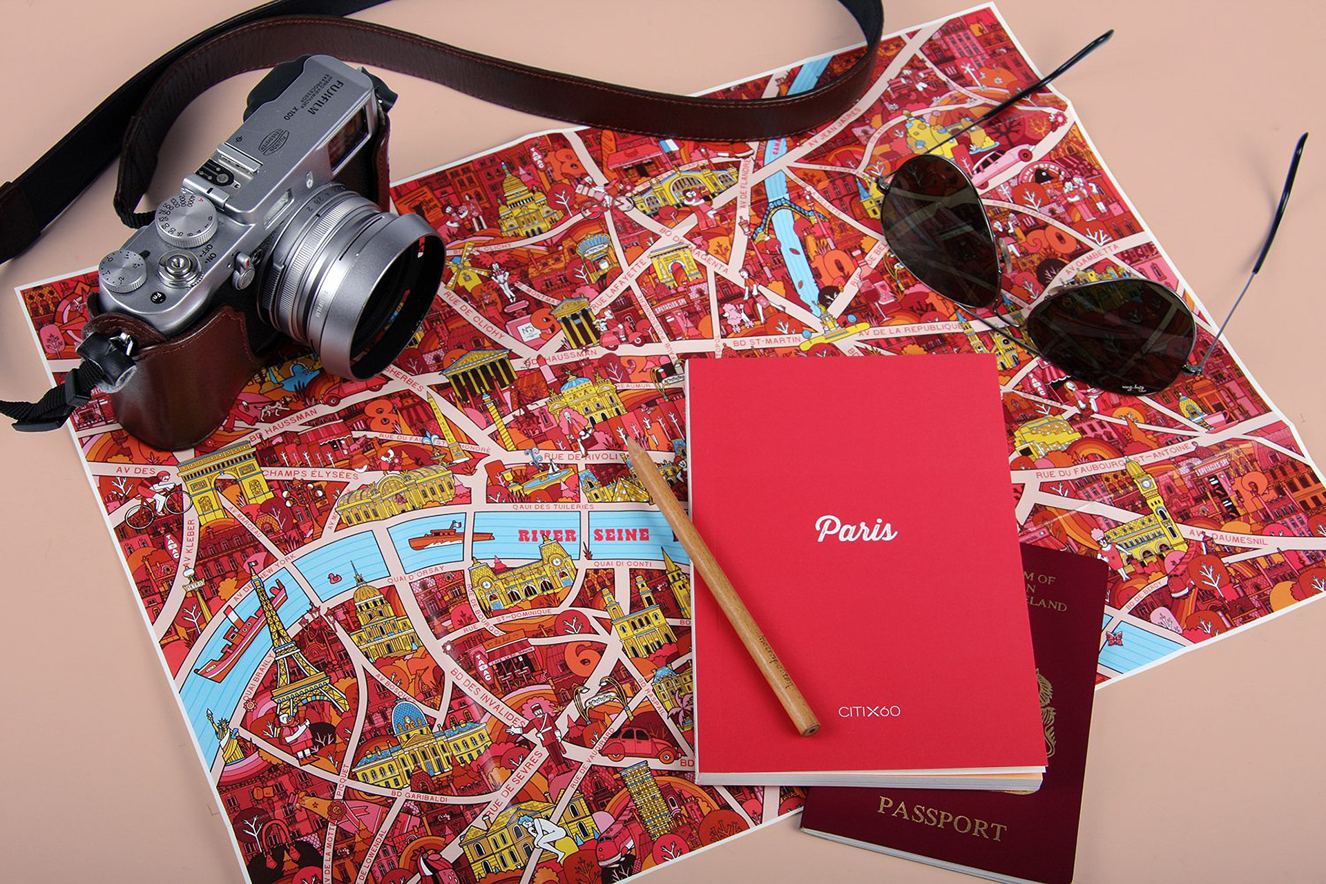
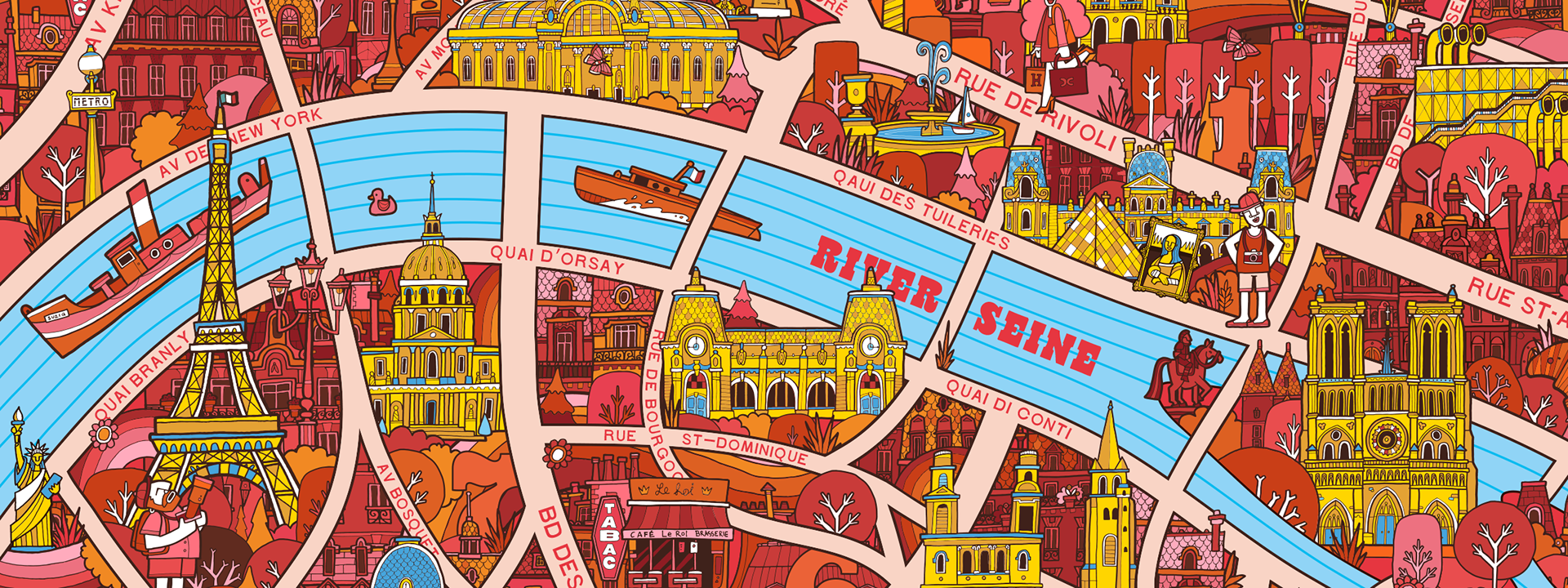
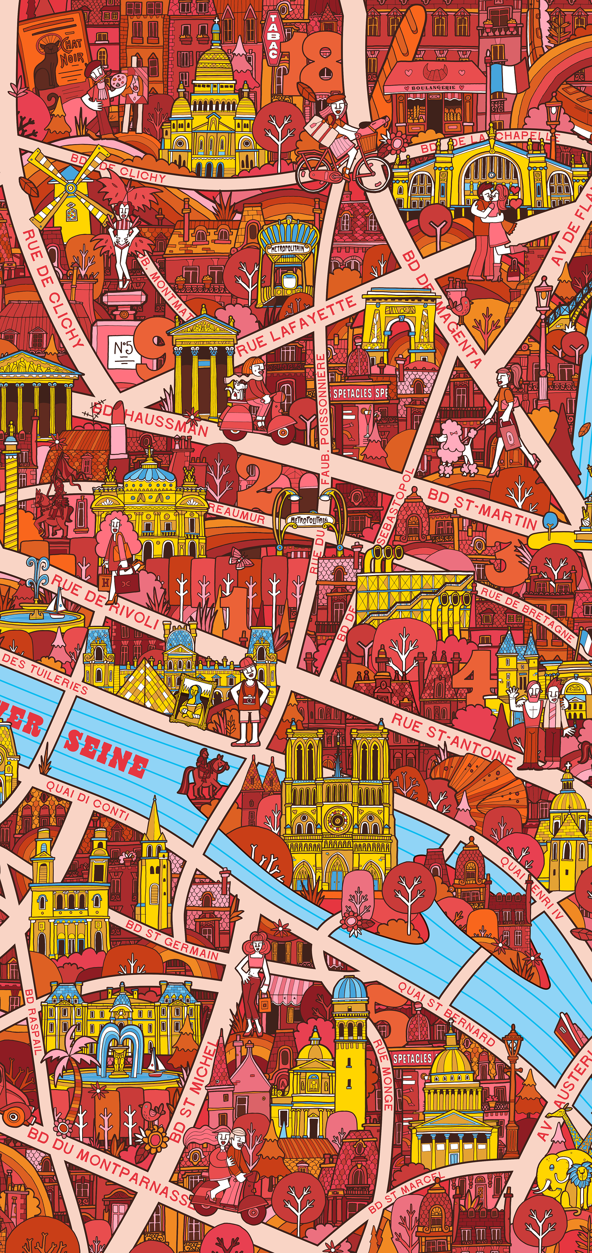
The design I illustrated for Paris was used as a fold out map that doubled as the cover for the book when folded around. The map was also sold as limited edition fine art prints, in two different sizes, all signed & numbered.
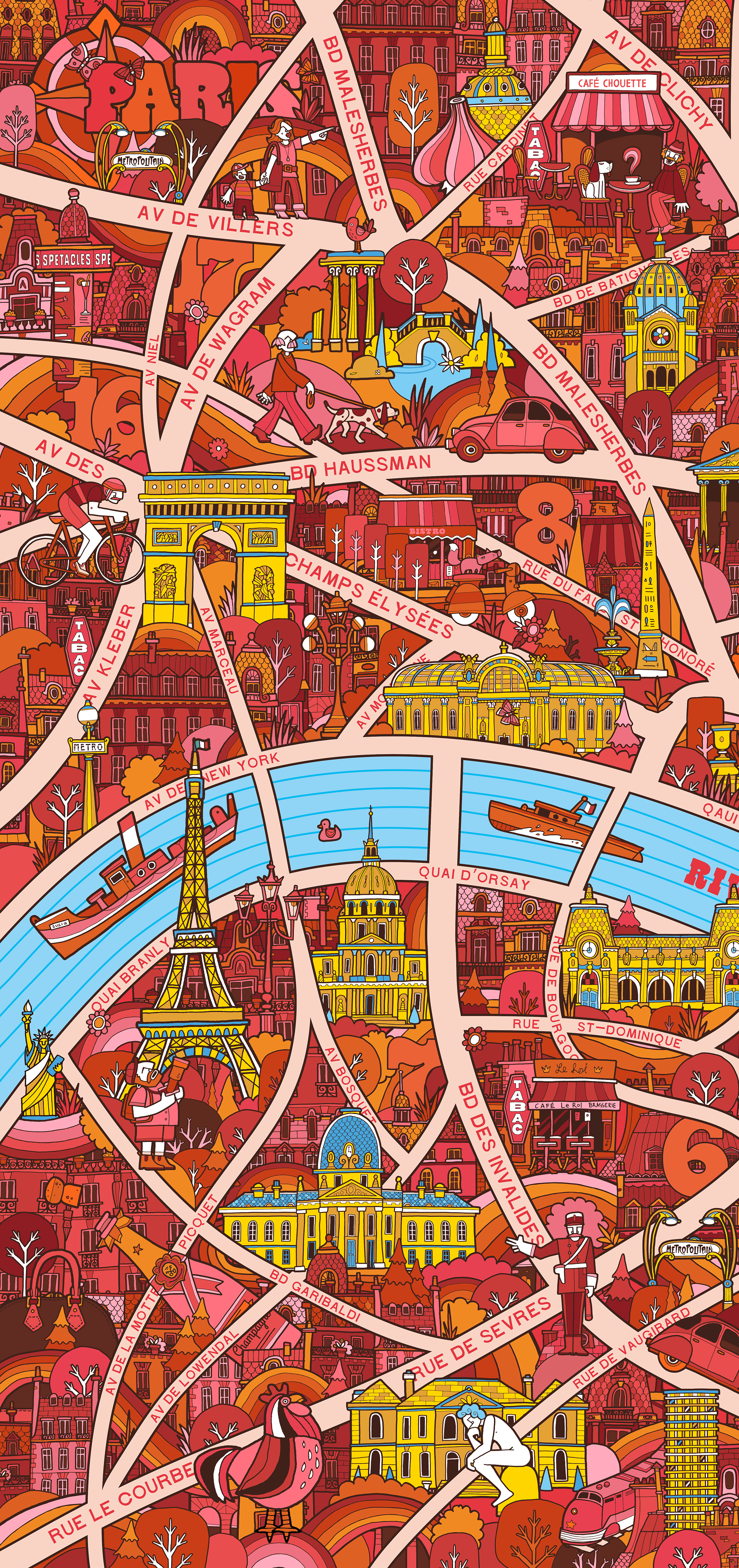
I designed this map when I lived in the French capital and I remember wandering round each of the areas, pastry in hand soaking up the atmosphere! So from a personal point of view a nice 'souvenir' of my years in the 'city of light' - Ooh la la!
THANKS TO
Agency | Viction Workshop
Art Director | Victor Cheung
Project Coordinator | Jovan Lip
Graphic Design | Beryl Kwan


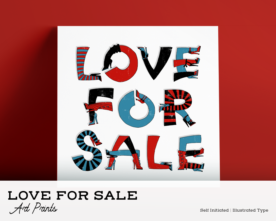
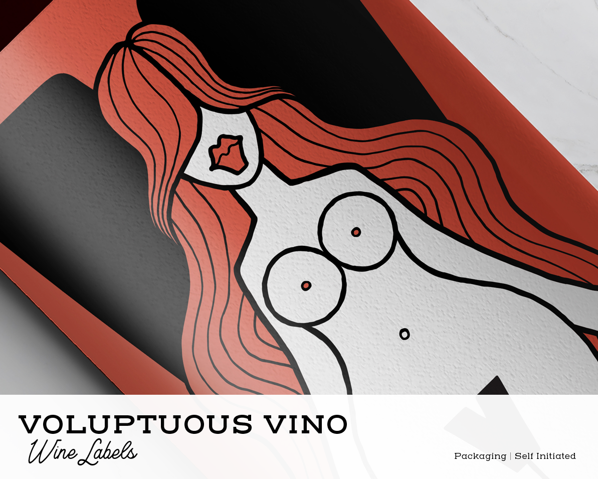
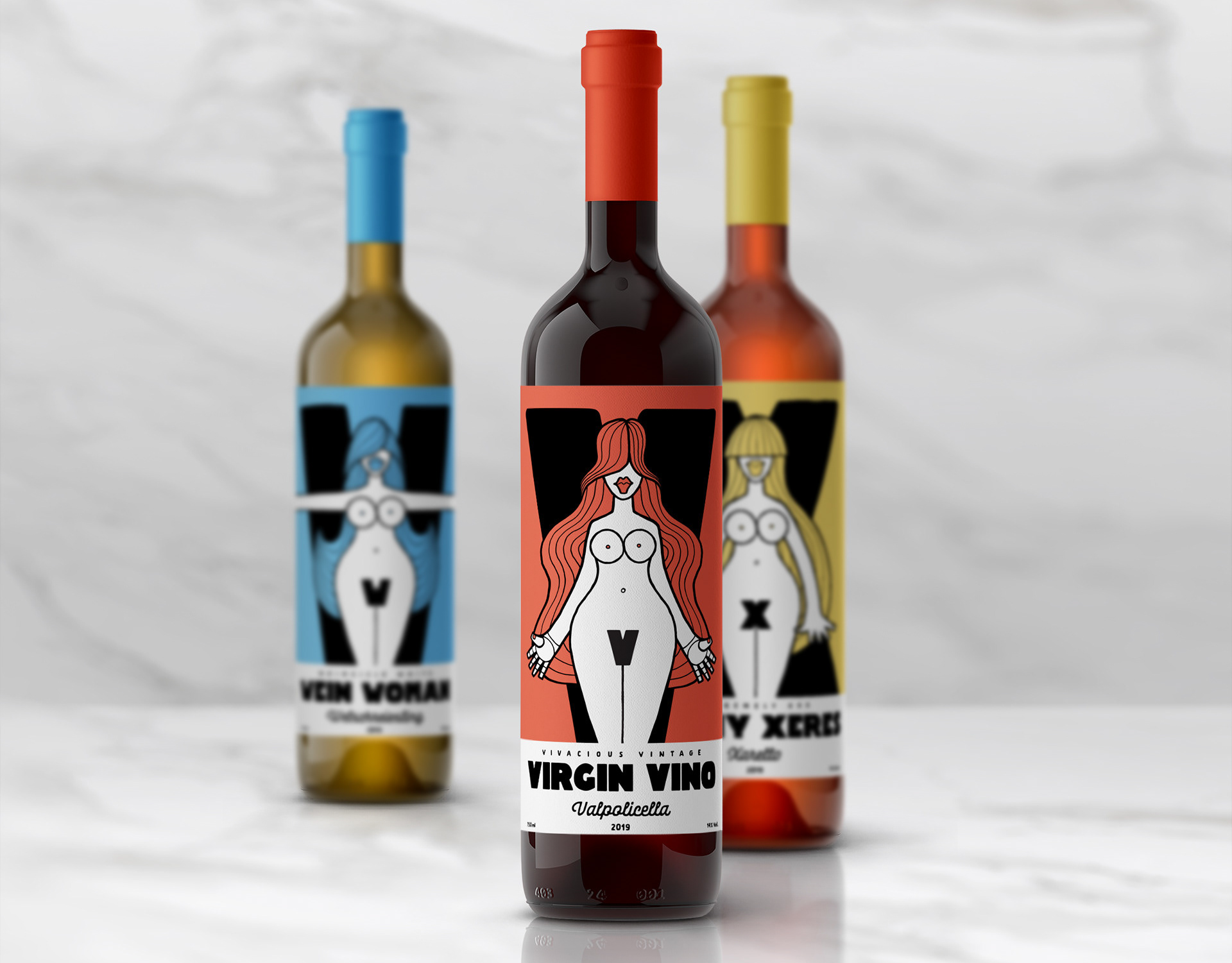
Allan Deas • Illustration • Graphic Design • Art Direction
+ 44 7947 750 970 • + 34 680 44 20 60